
How we forecast what the weather will do to your operation
Forecasts are not decisions. Today someone translates forecasts into impact by hand, which is slow, inconsistent and often too late. WeatherOptics does the translation: we forecast impact, not just weather.
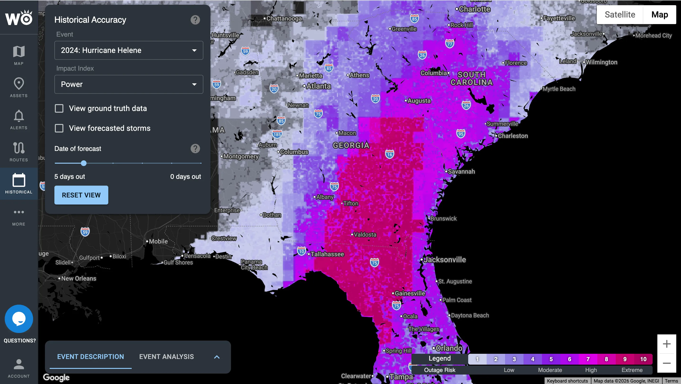
The power outage forecast for Hurricane Helene in the Impact Intelligence Platform, four days out.
One engine behind every WeatherOptics product
Every data family and solution runs on the same three ingredients: our own AI weather model, the ground your operation runs on, and 15+ years of what weather has actually done. Together they are why our impact forecasts are better.
Weather + your operation + impact history = impact insight
HYPERR, our own AI weather model
3-km resolution worldwide, refreshed every 15 minutes, out to 7 days, with up to 40% lower forecast error than NOAA models (12-month study).
Geospatial and infrastructure data
The ground your operation runs on: roads, topography, flood zones, tree density, rivers and the power grid.
15+ years of impact history
What weather has actually done, including 40M+ connected vehicles, storm damage and road closures. Our impact models learn from it and keep improving as what actually happens is fed back in.
Four families of data, each answering one question
Every WeatherOptics product is built from them. Impact Models predict the impact; Impact Reports confirm it.
Hover or tap a family to see what's in it.
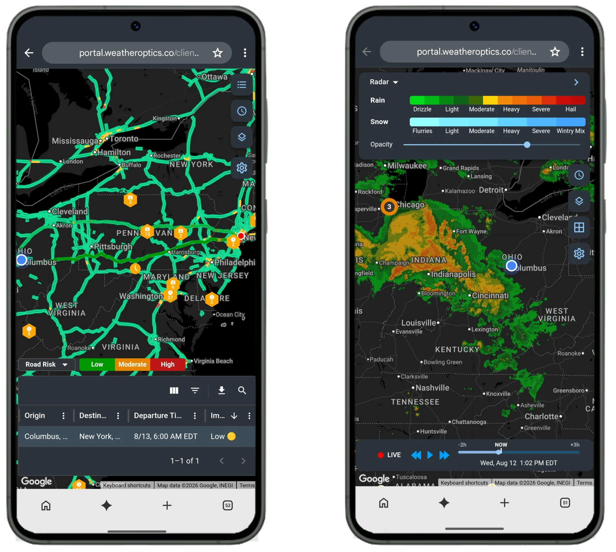
What will the weather be at this exact spot?
Hyperlocal forecasts from our own AI weather model, down to your exact location: 3-km resolution, every 15 minutes, up to seven days ahead, and the next six hours in 15-minute steps.
Feeds Impact Models and Critical Events, so every score and event outline starts from a sharper forecast.
See Hyperlocal Weather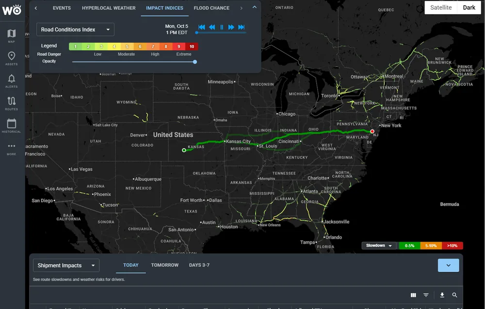
How badly will the weather hit this asset, and when?
One 0–10 Impact Risk Score per Index for every truck, route and site, so you see the outcome: a 70% chance this store loses power tomorrow afternoon.
Built on Hyperlocal Weather. Impact Models predict the impact; Impact Reports confirm it, and what actually happens is fed back so the models keep improving.
See Impact Models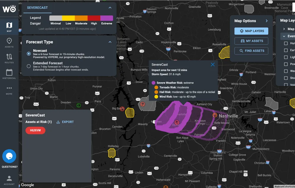
What major weather is coming, and what will it hit of mine?
Every major weather event coming your way, outlined and summarized in plain language, with which of your trucks, routes and sites are in it.
Draws on Hyperlocal Weather and Impact Models for each event's footprint, timing and expected impacts. SevereCast shows the real threat inside a warning, storm by storm.
See Critical Events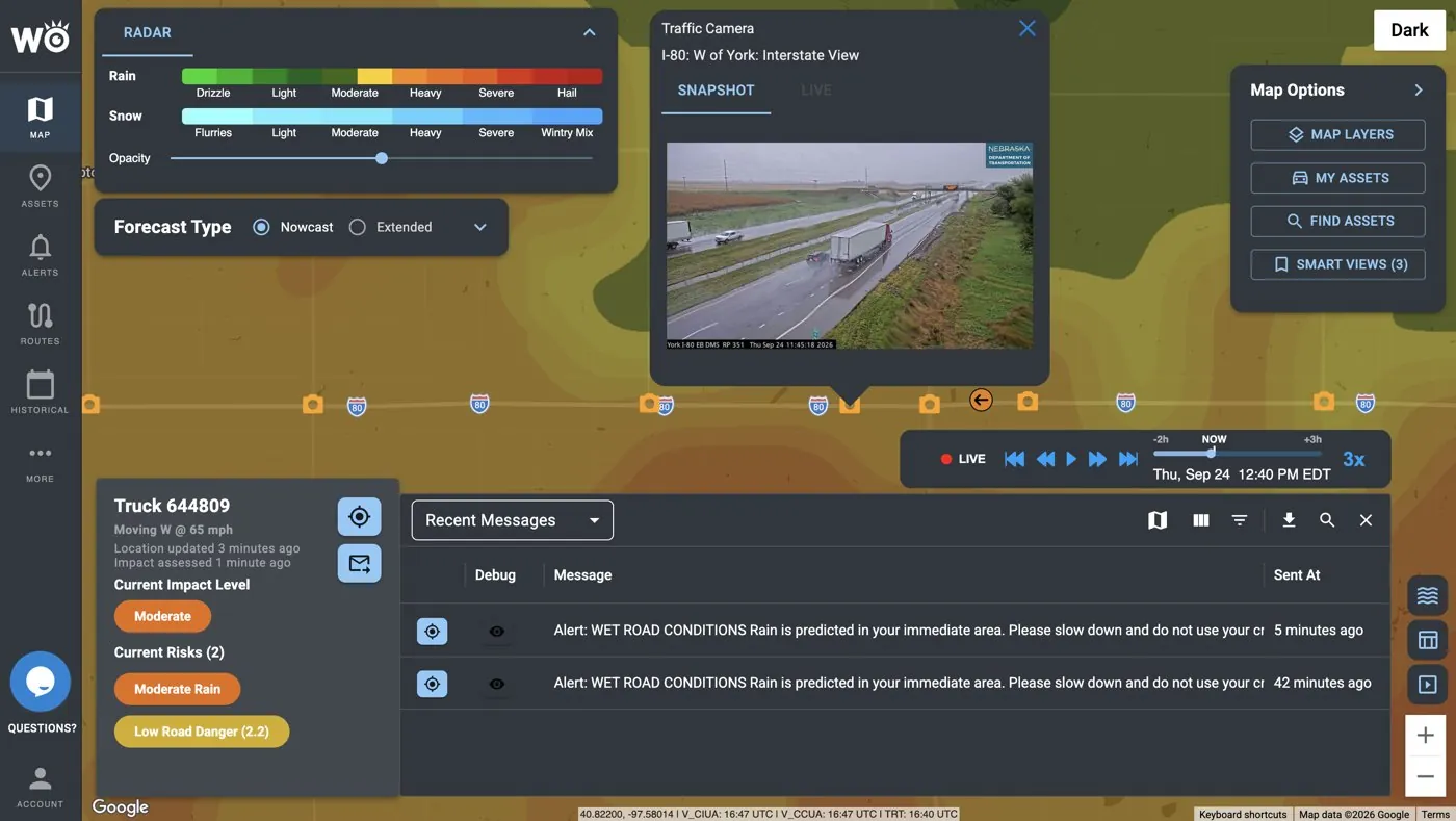
What did the weather actually do, and where?
After the storm, see where power actually went out, where the damage is and which roads closed, against your sites.
Confirms what Impact Models predicted and what Critical Events outlined, and feeds back into the models.
See Impact ReportsThe same weather lands differently
One inch of snow in Chicago is a normal day; one inch in Dallas shuts the roads. Generic weather can't tell the difference. Impact models can.

One layer: the forecast. Which stores, sites, routes and trucks it affects is left for your team to work out.
Pointed at your routes, vehicles, sites and regions
Point WeatherOptics at the things you run. The data, your asset and your threshold add up to an alert.
Routes and shipments
Each shipment's route and departure time, simulated for adjusted ETA, slowdown and road risk.
Vehicles
Every truck and the weather impact ahead of it, with alerts to the driver and dispatcher when a threshold is crossed.
Sites
Stores, DCs, hubs and facilities: which ones the weather will hit, how badly and when.
Regions
One picture of what a storm will do to your region, days ahead and through the response.
Illustrative example: not "Heavy sleet alert", but "Route AA132, New York to Portland: 1-hour delay from heavy sleet on I-95 between exits 12 and 14." You choose when it fires: on the 0–10 scale, seven and above is where high impact starts.
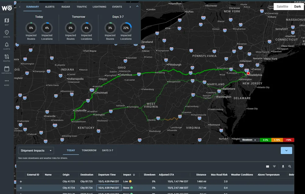
Every load · planned routes with departure time, slowdown, adjusted ETA and road risk.
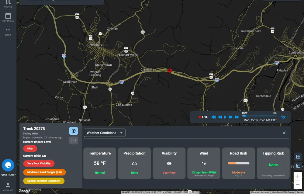
Every truck · road risk and rollover risk on the road ahead of it.
Plan, act, respond, then recover and prove it
The same picture carries your team through a storm, from days out to the review afterwards.
Days ahead: plan
See which loads, lanes, stores and sites face weather risk 3–7 days out. Re-tender loads, pre-position crews, pre-call customers.
Hours ahead: act
Hold, reroute or re-time loads. Warn drivers before conditions turn dangerous. Send weather-adjusted ETAs.
During: respond
Know which sites sit in a storm's next 15–60 minutes, which roads are closing, and when it's safe to resume.
After: recover and prove
See where damage, outages and closures are. Document what happened for claims, reviews and disaster declarations.
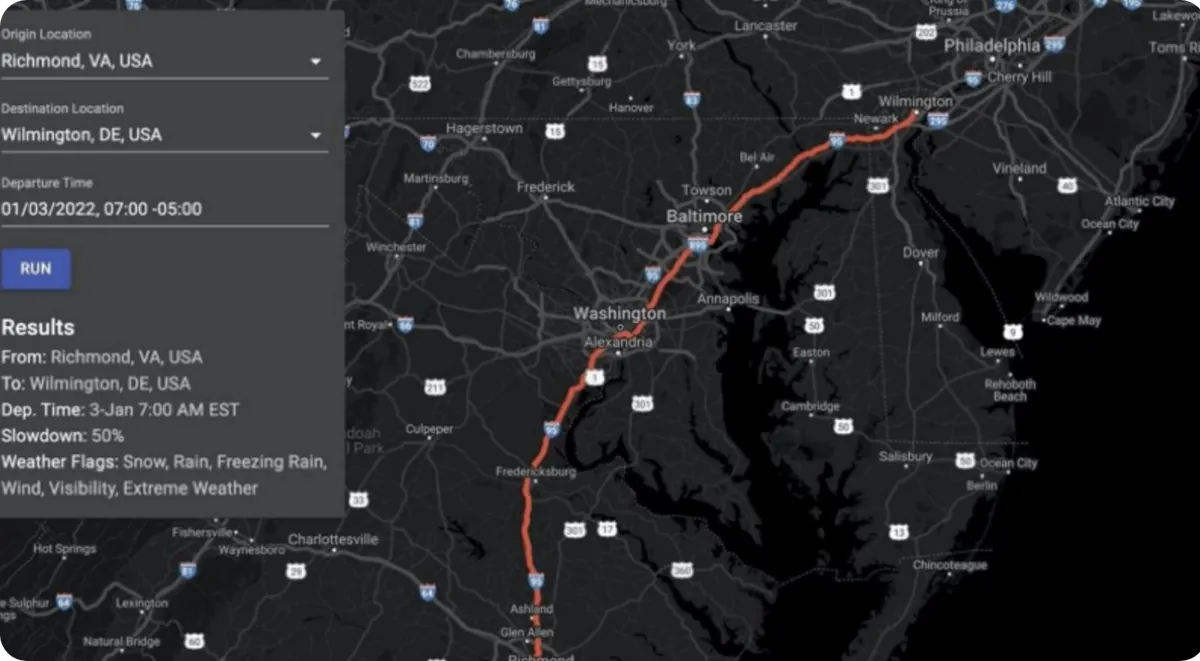
Jan 2, 7:00 PM ET · Shipment Intelligence (RightRoute) flags I-95 from Richmond to Wilmington in red, 36+ hours ahead.
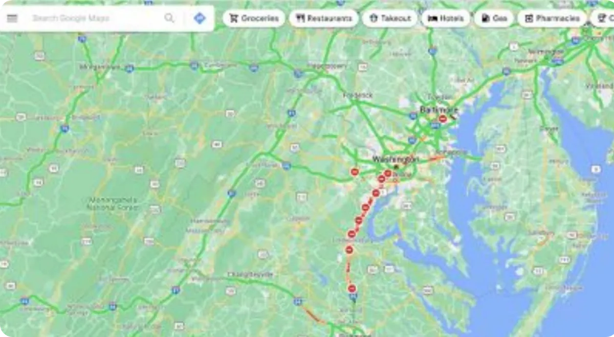
Jan 4, 10:15 AM ET · The same stretch at a standstill in live traffic.
Delivered where you already work
Most customers start in the platform; teams that want it automated never have to log in.
Impact Intelligence Platform
Your assets, risk and alerts on one map, in the browser.
Alerts
Text, email and in-cab audible alerts, sent only when your thresholds are crossed.
WeatherOptics Briefings
The morning briefing and event summaries, in plain language.
API, webhooks and map tiles
99.9% uptime, for your own systems. See the API
Inside your tools: Trimble, Platform Science, Samsara, Juvare WebEOC, Esri ArcGIS, HERE and Google Maps.
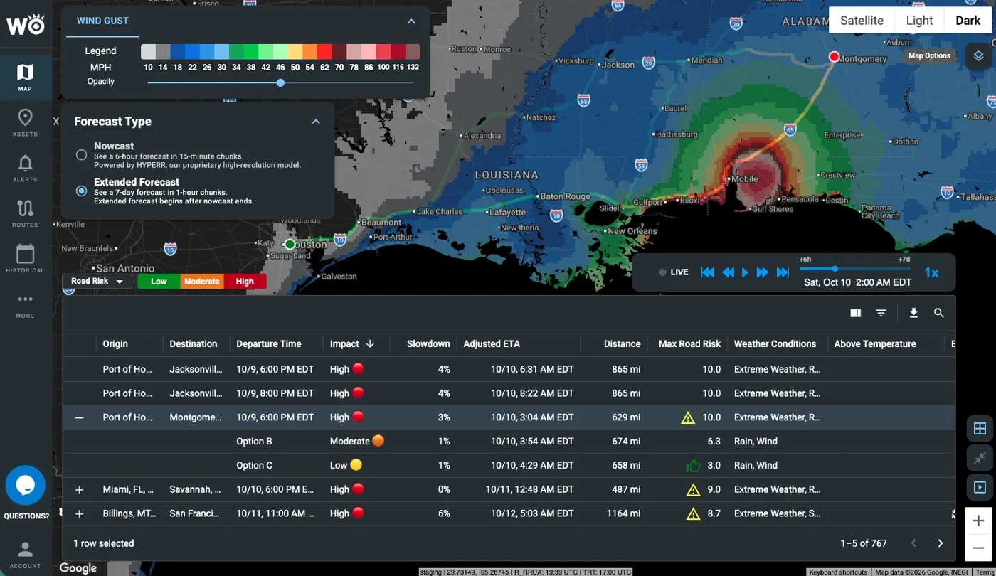
Impact Intelligence Platform · a route through Hurricane Isaias compared with an alternative that avoids it.
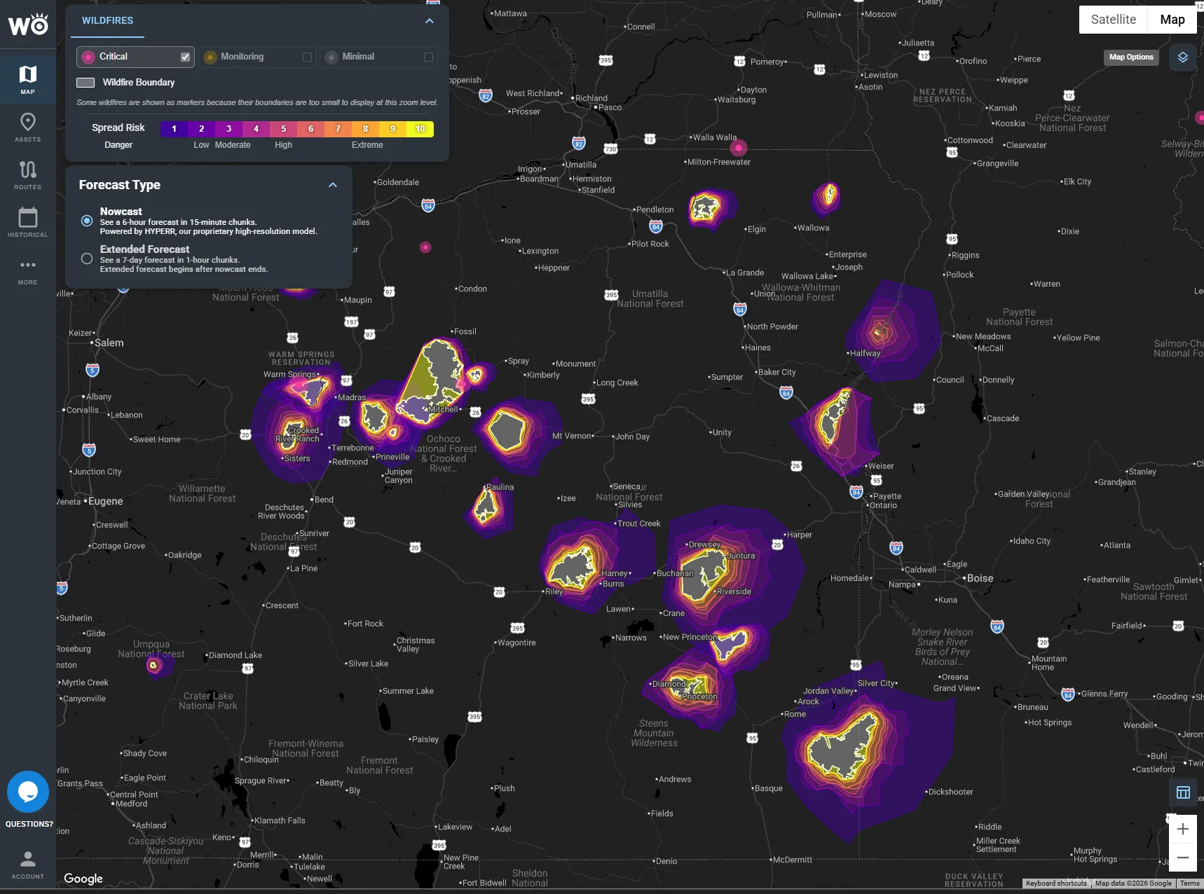
Same platform, any hazard · wildfire spread risk across a region, with the sites in it.
One engine, put to work for your industry
Every industry runs on the same engine and the same data, pointed at the assets and decisions your team owns. Pick yours to see the products that fit.
We warn your drivers and dispatchers which trucks are heading into dangerous weather, hours to days before it hits, inside the ELD they already use.
150,000+ trucks run on WeatherOptics alerts, and fleets using our predictive products see 42% fewer weather-related incidents on average (22% with real-time products, across multiple enterprise fleets).
See WeatherOptics for truckingWe tell you which shipments the weather will make late or put at risk, days before they leave, so you can hold, re-time, reroute or warn your customer first.
58% more accurate ETAs than HERE in severe weather (419 trips), and an estimated $1M+ a year for a major shipper.
See WeatherOptics for shippers
We put weather delay and risk into every lane before you price or tender it, so the margin you quote is the margin you keep.
58% more accurate ETAs than HERE in severe weather (419 trips).
See the APIOne picture of what the storm will do to your region, days ahead, through the response, and a record of what happened for recovery.
Hurricane Dorian road closures called 48 hours ahead, and up to 40% lower forecast error than NOAA models (12-month study).
See Wildfire Intelligence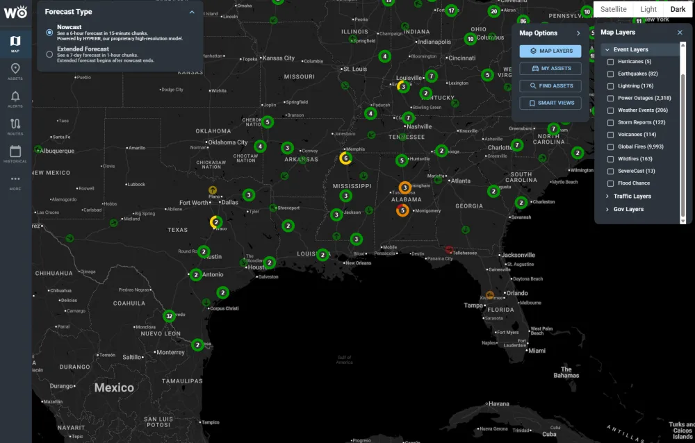
We tell you which stores, DCs and deliveries the weather will hit and how badly, so stores, supply chain and safety act on one plan.
SevereCast called 95% of storms correctly, vs about 70% for NWS alerts, with 10x fewer false alarms (6,033 verified reports, 2025 season).
See Critical EventsAdd impact intelligence to your product without building a weather team: risk scores, alerts and ETAs your customers act on, powered by WeatherOptics.
Our models learn from 40M+ connected vehicles, and HYPERR, our own AI weather model, has up to 40% lower forecast error than NOAA models (12-month study).
See the APIResults across fleets, supply chains and storm response
Every figure comes with its source.
Ahead on Hurricane Dorian road closures.
Fewer weather-related incidents on average for fleets using our predictive products; 22% with real-time products, across multiple enterprise fleets.
More accurate ETAs than HERE in severe weather (419 trips).
Of storms called correctly by SevereCast, vs about 70% for NWS alerts, with 10x fewer false alarms (6,033 verified reports, 2025 season).
See which storms we would have flagged
Send us a handful of past incidents, delayed shipments or storms. We'll show you which ones we would have flagged, how far ahead, and what that was worth.
Become a WeatherOptics insider
Get insights on weather intelligence and operational resilience delivered to your inbox.