
Data and solutions that forecast impact, not just weather
Our engine produces the data, and our solutions put it to work on a specific job. Both are set up on your routes, vehicles, sites and regions and arrive where you already work.
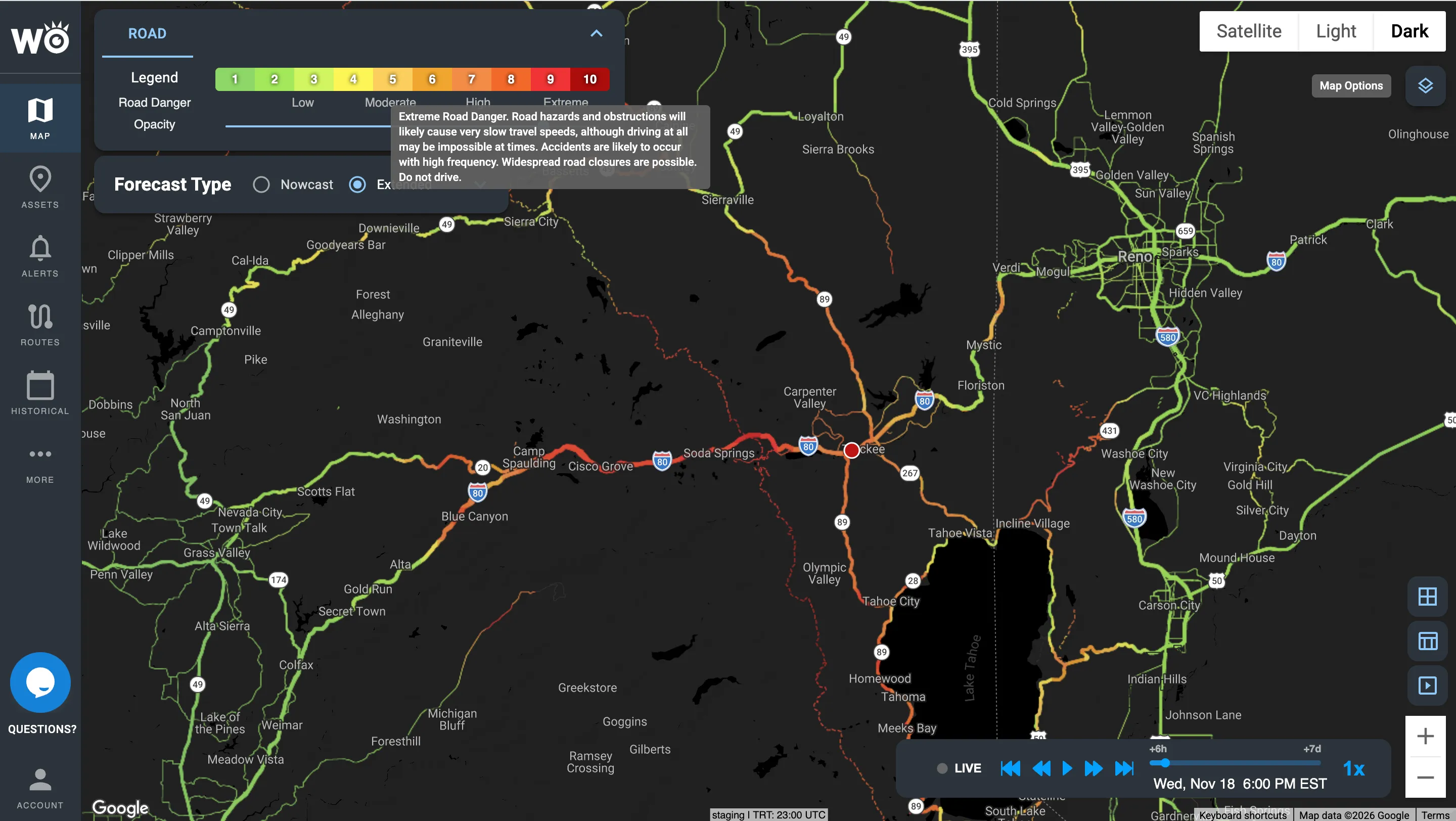
The Road Risk Index in the Impact Intelligence Platform: how dangerous the roads will be, scored 0 to 10.
Trusted across emergency management, trucking, logistics and retail







Why our impact forecasts are better
HYPERR, our own AI weather model, forecasts at 3-km resolution worldwide, refreshed every 15 minutes, out to 7 days. We layer it over roads, terrain, flood zones, rivers and the power grid, and over 15+ years of what weather has actually done, including 40M+ connected vehicles, storm damage and road closures.
Lower forecast error than NOAA models (12-month study).

Four families of data, from the forecast to what actually happened
Each family answers one question. Use it on its own, through the platform, alerts or the API, or as part of a solution.

What will the weather be at this exact spot?
Hyperlocal forecasts from our own AI weather model, down to your exact location: precipitation, freezing rain, wind, temperature, visibility, lightning, radar and government alerts, up to seven days ahead.
Learn more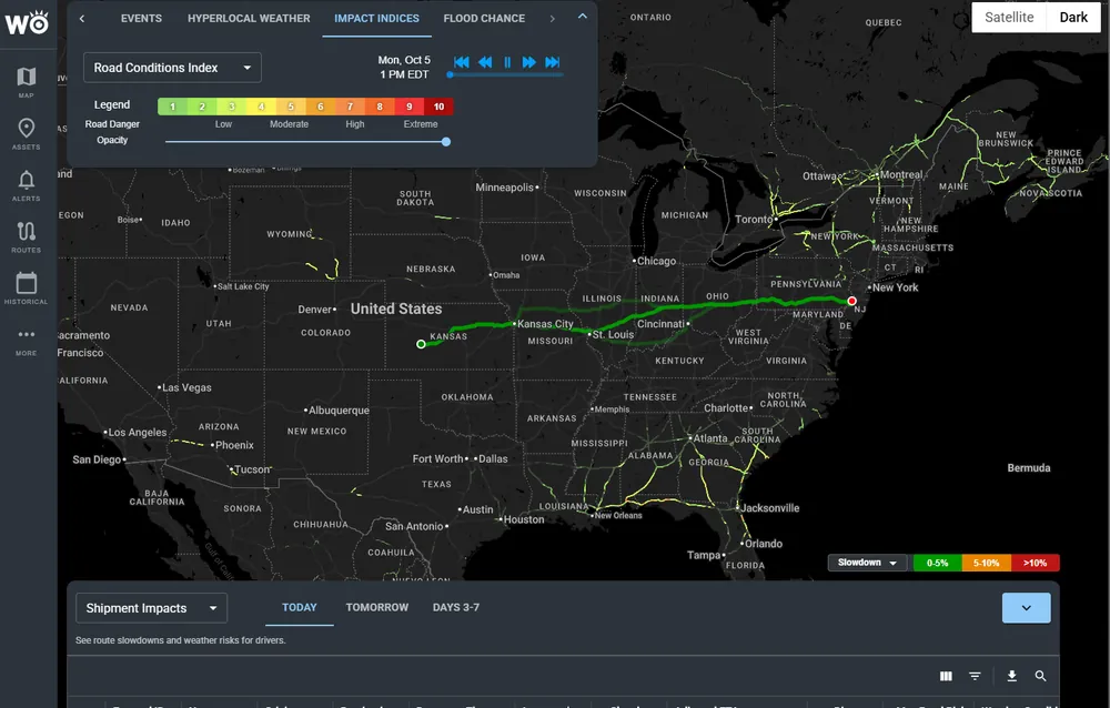
How badly will the weather hit this asset, and when?
From a 70% chance this store loses power tomorrow afternoon to which lanes turn dangerous for high-profile trailers. Eleven Indexes, including the Road Risk Index, Rollover Index, Flood Risk Index and Power Outage Index.
Learn more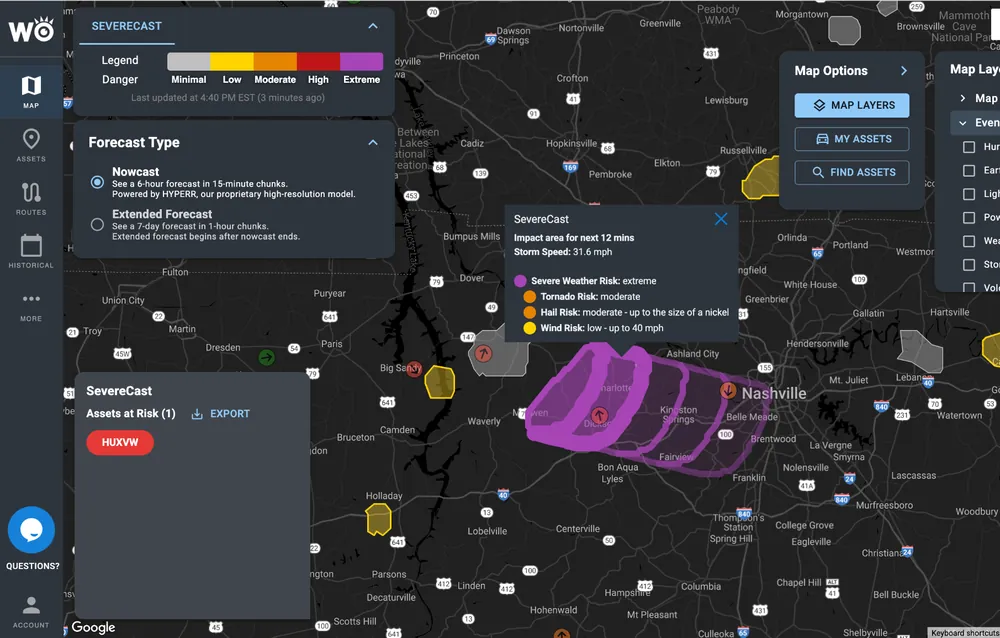
What major weather is coming, and what will it hit of mine?
Every major weather event coming your way, outlined and summarized in plain language, with which of your trucks, routes and sites are in it. Includes SevereCast, which shows the real threat inside a warning, storm by storm.
Learn more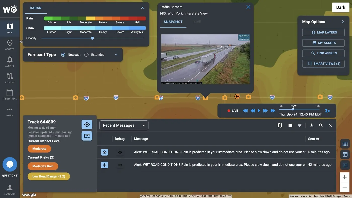
What did the weather actually do, and where?
After the storm, see where power actually went out, where the damage is and which roads closed, against your sites. Includes Live Road Status: closures, truck restrictions and 40,000+ live road cameras.
Learn moreImpact Models predict the impact; Impact Reports confirm it. SevereCast and Live Road Status are also available on their own.
Built from our data for the job you need done
Each solution answers one question for one kind of team, built from the data above and set up on your own assets.
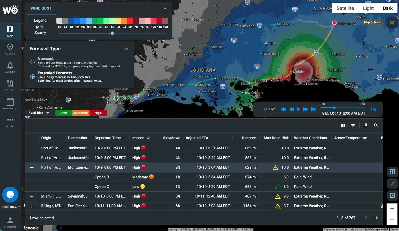
Will this load arrive on time and safely?
Simulates the weather and its impact along each shipment's route and departure time: adjusted ETA, slowdown, road risk and safer options. Comes in three versions: TripCast, FreezeGuard and Range.
Learn more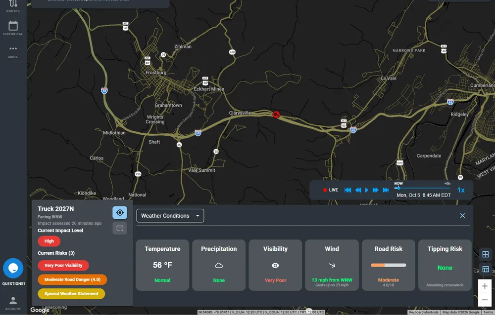
Which trucks are heading into danger, and does the driver know?
Connects to the ELD, watches every truck and the weather ahead of it, and sends in-cab and dispatcher alerts when a threshold is crossed, with the Rollover Index and Road Risk Index on every truck.
Learn more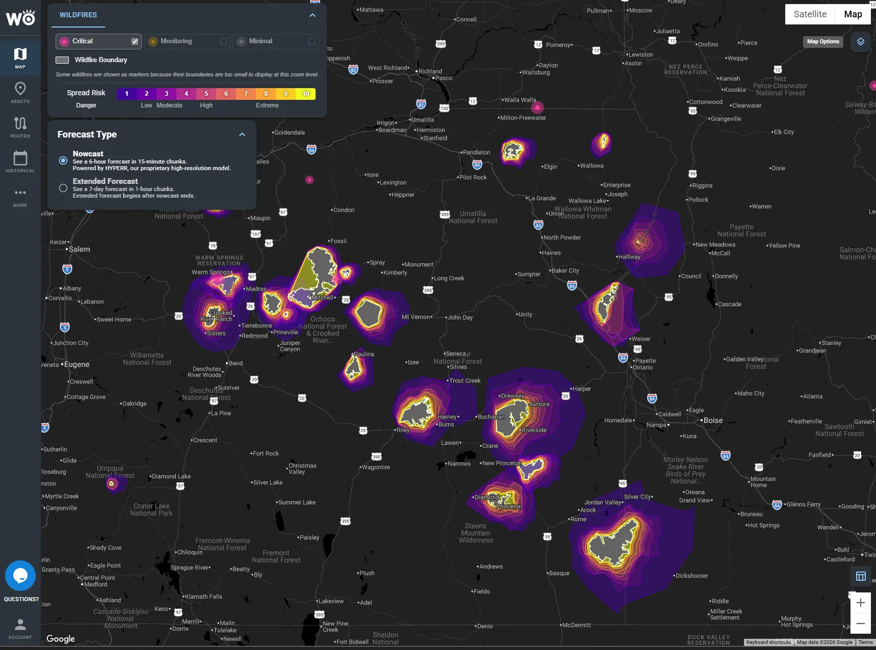
Where is fire burning, and where can it spread?
The Wildfire Conditions Index and Wildfire Spread Index plus satellite fire detections, against your sites, regions and routes.
Learn moreSet up on the things you run
Data plus your asset plus your threshold is an alert. Add what matters to you once, and everything above is applied to it.
Routes and shipments
Lanes, loads and trips, from origin to destination.
Vehicles
Your trucks, connected through the ELD you already use.
Sites
Stores, DCs, hubs and facilities.
Regions
Counties, service areas or any custom area you draw.
Delivered where you already work
Most customers start in the platform. Teams that want it automated never have to log in.
Impact Intelligence Platform
Your assets, risk and alerts on one map in the browser.
Alerts and WeatherOptics Briefings
Text, email and in-cab audible alerts, sent only when your thresholds are crossed, plus the morning briefing and event summaries.
API
API, webhooks and map tiles, with 99.9% uptime. See the API
Inside your tools
Trimble, Platform Science, Samsara, Juvare WebEOC, Esri ArcGIS, HERE and Google Maps.
The same system, set up for your team
Trucking
We warn your drivers and dispatchers which trucks are heading into dangerous weather, hours to days before it hits, inside the ELD they already use. For trucking
Shippers
We tell you which shipments the weather will make late or put at risk, days before they leave, so you can hold, re-time, reroute or warn your customer first. For shippers
3PLs
We put weather delay and risk into every lane before you price or tender it, so the margin you quote is the margin you keep.
Emergency management
One picture of what the storm will do to your region, days ahead, through the response, and a record of what happened for recovery.
Retail
We tell you which stores, DCs and deliveries the weather will hit and how badly, so stores, supply chain and safety act on one plan.
Partners and platforms
Add impact intelligence to your product without building a weather team: risk scores, alerts and ETAs your customers act on, powered by WeatherOptics.
See which storms we would have flagged
Send us a handful of past incidents, delayed shipments or storms. We'll show you which ones we would have flagged, how far ahead, and what that was worth.
Become a WeatherOptics insider
Get insights on weather intelligence and operational resilience delivered to your inbox.