Know where wildfire is burning and where it will spread
See active fires, how likely new fire is, and where each fire will spread over the next 24 hours, against your sites, vehicles and routes. Built for emergency managers and anyone with assets in fire country.
Trusted across emergency management, trucking, logistics and retail





From fire risk before ignition to fire on the ground
Wildfire Intelligence scores where new fire is likely, forecasts where each active fire will spread over the next 24 hours, and shows which of your sites, vehicles and routes are exposed.
Wildfire Conditions Index
Where the weather favors new fire, scored 0 to 10 across the United States, up to 7 days ahead.
Wildfire Spread Index
Where each active fire is most likely to spread over the next 24 hours, updated every hour.
Faster fire detection
Satellite and land data layered over government reports, so a fire has a location and a shape before an official perimeter is posted.
Threat classification
Every active fire ranked Critical, Monitoring or Minimal, so you know which ones need attention first.
Assets at risk
Your facilities, stores, vehicles and routes laid over the projected spread, with alerts when your thresholds are crossed.
Fire status
Acres burned, suppression and containment for each active fire, in the same view as the forecast.
The data: spread forecasts update every hour at finer than 3-km resolution, on a nine-tier scale from Marginal to Extreme, with a 0 to 10 score for every location.
Tested on 854 fires: it knows where a fire is going next
We ran the Wildfire Spread Index against 854 historical fires. Where it forecast Extreme risk, the fire arrived nine times out of ten. Where it forecast none, the fire almost never did.
In Extreme-risk zones. Fire was later observed in nine of every ten.
In Critical-risk zones. Fire was later observed in about two of every three.
In Moderate-risk zones. Fire was later observed in one of every three.
Outside the lowest-risk zone. Fire almost never reached areas the index left clear.
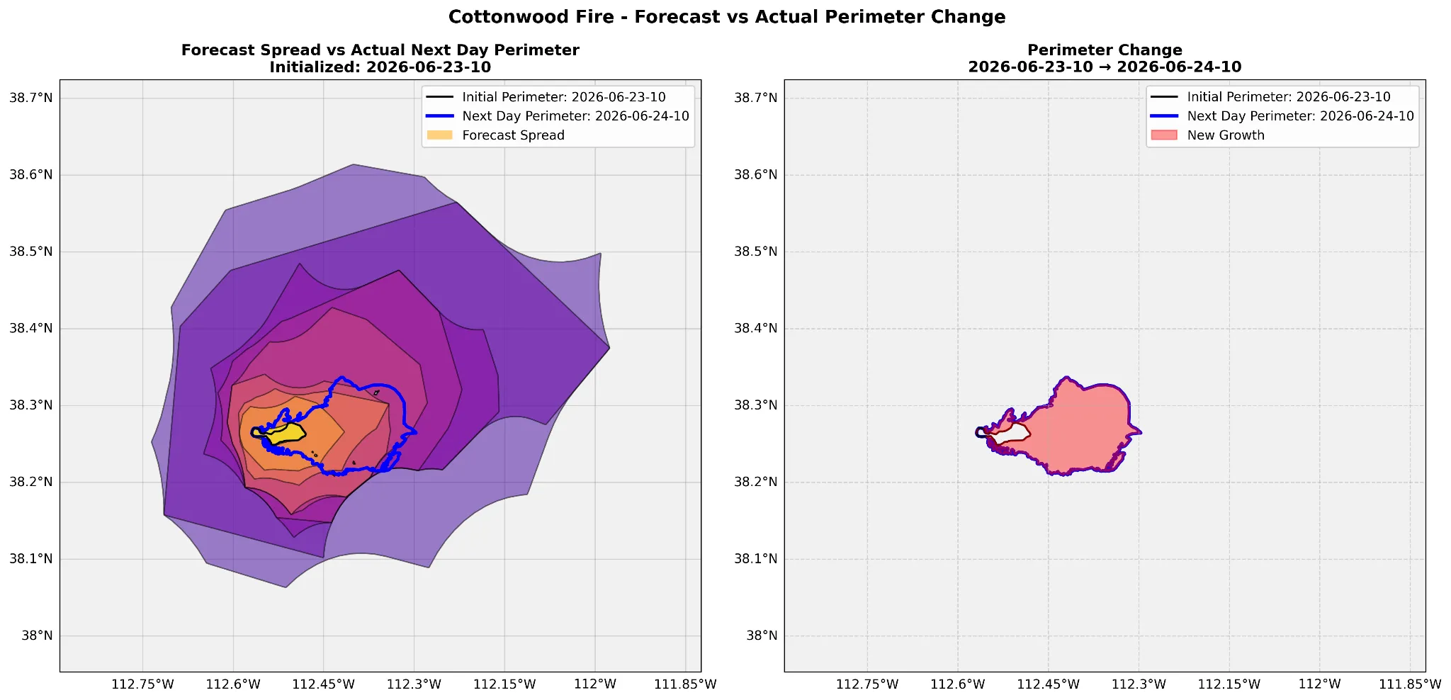
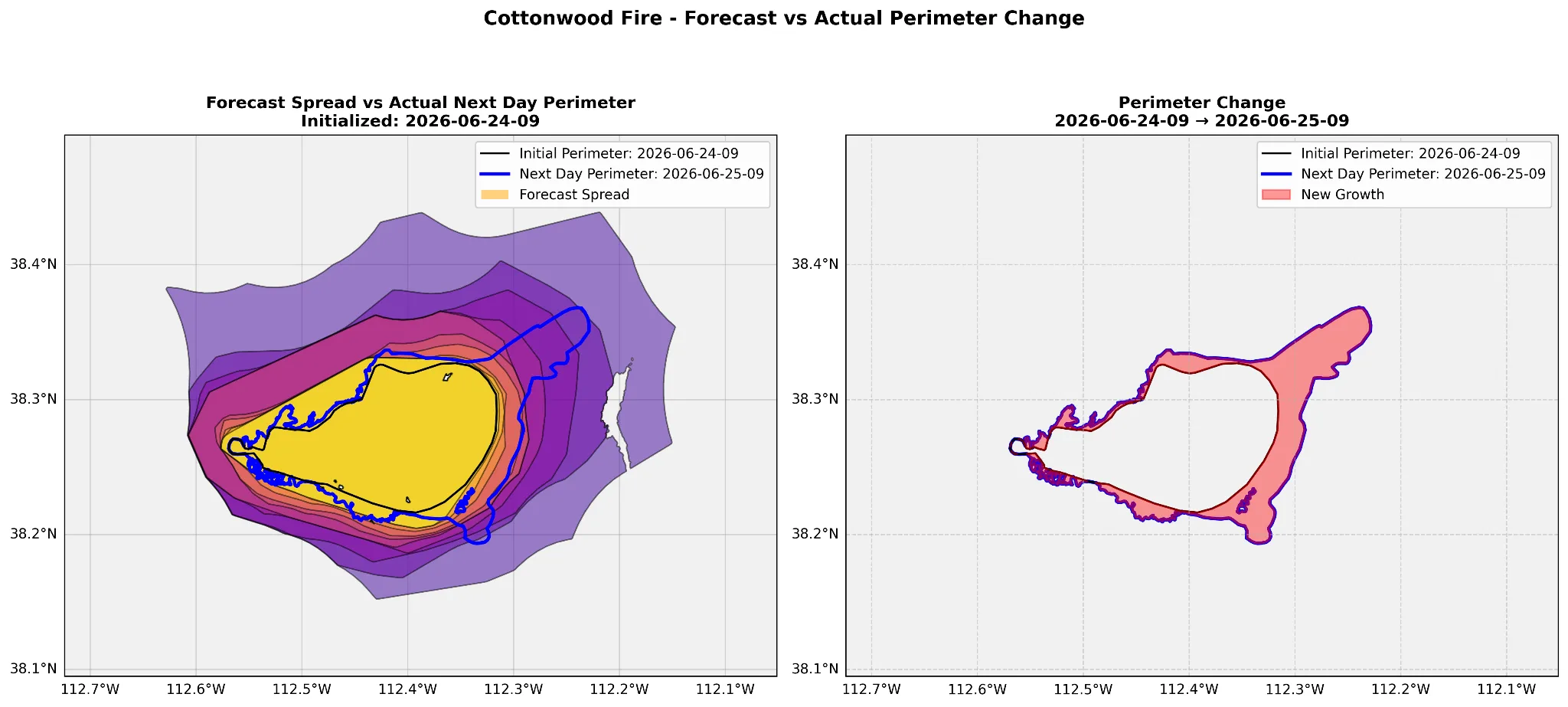
Cottonwood Fire, June 2026: the forecast against what happened
June 23: a forecast before any official perimeter
The index issued a 24-hour spread forecast before a government perimeter was available, and identified the fire's main direction of growth.
June 24: an updated forecast, the same result
The next day's forecast again matched where the fire grew through June 25, and the areas most likely to be affected.
Double Creek Fire, 2022: ignited by lightning on August 30, it passed 50,000 acres within a week and eventually burned more than 150,000. The Wildfire Spread Index predicted its spread to the north and south, rating those areas 7 to 10.
One fire forecast, a different decision for each team
Emergency managers, fleets, shippers and retailers all read the same forecast, and each acts on it differently.
Emergency management and government
See which communities, roads and infrastructure a fire threatens, to plan evacuations, pre-stage resources, decide on road closures and prioritize between fires.
Trucking and logistics
Check whether a fire is projected to move toward a route, terminal or distribution center, and reroute only the loads with real exposure.
Fleets and drivers
Alert drivers when there is an active wildfire nearby, or a high risk of new fire along the road ahead.
Retail and enterprise safety
Watch stores, warehouses and offices against the projected spread, and prepare closures or alternate distribution before the fire arrives.
Delivered where you already work
Most customers start in the platform; teams that want it automated never have to log in.
Impact Intelligence Platform
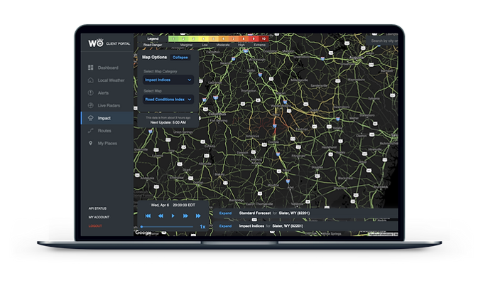
Your sites, regions and routes, with fire risk and alerts, on one map in the browser.
Alerts and briefings
Text and email alerts, sent only when your thresholds are crossed, plus WeatherOptics Briefings: the morning briefing and event summaries.
API, webhooks and map tiles
99.9% uptime, for your own systems and tools such as Juvare WebEOC and Esri ArcGIS.
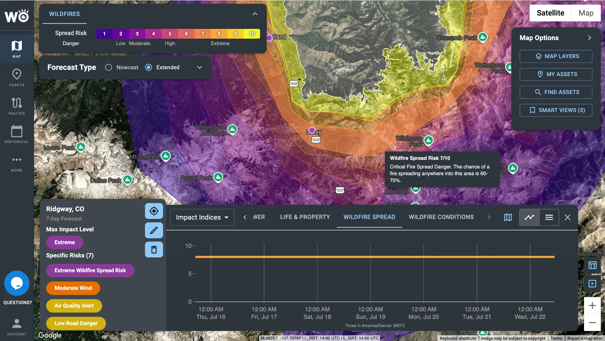
The Wildfire Spread Index in the Impact Intelligence Platform: graduated spread zones around an active fire, with its threat level.
The data behind Wildfire Intelligence
Wildfire Intelligence puts WeatherOptics data to work on one job: knowing where fire is, and where it will go.
Impact Models
The Wildfire Conditions Index and Wildfire Spread Index: how likely new fire is, and where it can spread.Explore Impact Models
Impact Reports
Satellite fire detections, alongside power outages, damage reports and more: what the weather actually did, and where.Explore Impact Reports
Hyperlocal Weather
Hyperlocal forecasts from our own AI weather model, down to your exact location.Explore Hyperlocal Weather
Fire and land data
Government fire reports and perimeters, real-time satellite detections, and the terrain, vegetation and fuel a fire is burning through. The model is trained on thousands of historical fire-spread events.
See which storms we would have flagged
Send us a handful of past incidents, delayed shipments or storms. We'll show you which ones we would have flagged, how far ahead, and what that was worth.
Become a WeatherOptics insider
Get insights on weather intelligence and operational resilience delivered to your inbox.